How UAVs Change Disaster Management, Civil and Nature Protection
Use cases, benefits and limitations of UAVs in such civil applications as civil protection, marine and land surveillance, disaster management and wildlife monitoring.

In today’s reality of the biggest continental war which russia started by invading Ukraine, it is hard to associate drones with anything but weapons. At least, from a perspective of a Ukrainian. That said, there are many more applications of Unmanned Arial Vehicles (UAVs) a.k.a drones than physically destroying the enemy. The Federal Aviation Administration (FAA) registered more than 800K drones in the US by 2022 (1) and in the UK it is expected to be more than 900K drones by 2030 (2). This growth has been fuelled by technological advancement as well as e-commerce creating tens if not hundreds of use cases across various industries. The downside is that the opportunities proportionally expand for the “bad guys” that exploit drones for malicious purposes. In addition, UAVs have other significant limitations and challenges in particular around privacy and regulations.
DataRoot Labs is launching a research series that explore UAVs and their non-military applications across various industries. We start this series by highlighting companies that develop UAVs for catastrophes and natural disasters relief, wildlife protection, civil protection & law enforcement. Our research features the use cases and benefits of UAVs, the list of active incumbent players and rising startups, the investments and highlights current challenges and limitations.
Let’s look at each category one by one.
Civil Protection, Law Enforcement, Border Patrol
UAVs improve the efficiency of public safety operations by equipping the teams with reliable hardware that can gather high-quality information and deliver it in critical conditions. The use-cases are many and include anti-terror operations, border surveillance, coastal surveillance, anti-piracy operations, convoy security and perimeter security for large areas among others.
Most vendors in this section compete on performance, efficiency, durability, and such features as listening/overhearing potential, flight time, and load among others.
Thus, founded in response to the tragic 2017 Las Vegas shooting, BRINC company is deploying drones and other technologies that benefit the community. Its UAV - LEMUR S - features two ultra-sensitive microphones that pick up footsteps, opening doors, and human voices up to 23m away. It also can to survive high-energy crashes and continue operating afterward. Fully enclosed props allow LEMUR S to bounce off walls and push open doors (3). What makes LEMUR S particularly useful in search & rescue operations is that it can communicate and stream video through dense materials to ensure the safety of the pilot.
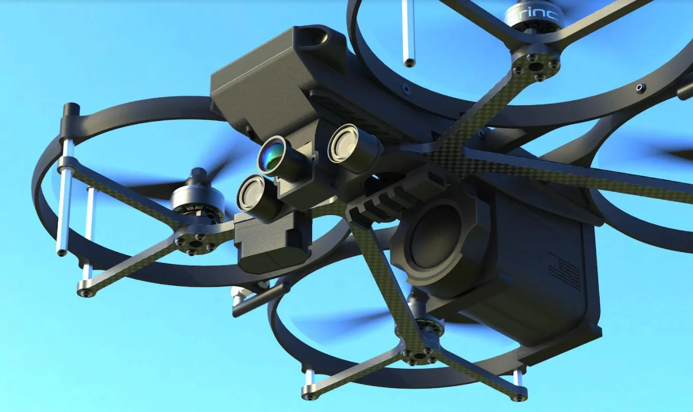
LEMUR S by BRINC
Another company - Ascent AeroSystems - designs and manufactures rugged “coaxial” drones for the industrial, public safety, and defense markets. Their unique cylindrical, portable, modular, and durable configuration is ideal for mission-critical operations in tough environments. With nearly 10 pounds available for batteries and payloads, their UAV Spirit features a highly streamlined airframe with a top speed of over 60 miles per hour that can operate in winds that would allegedly ground other UAVs (4).
Skyfront builds hybrid-electric drones that fly for 5 hours, a 10X improvement over battery-powered drones, for use in long-range infrastructure inspection, surveillance, and search & rescue missions (5). It boats very long ranges of up to 50 km and long flight times of up to 3-4 hours, all done in cold weather of up to -10C due to its G2K gas-electric hybrid propulsion system.
While the benefits of UAVs in this sector are clear, there are significant challenges and downsides associated with using drones for border control and civil protection such as:
-
Breach of personal privacy and individual liberties. If it ends up in the wrong hands, the footage could be used for blackmailing and scamming;
-
Legal and ethical framework. People leaving close to the borders do not consent to be constantly surveilled. Moreover, civilians will never know in which operations and to what end the footage was used;
-
UAVs can aggravate tensions over disputed borders as opposed to solving them.
Marine Surveillance, monitoring of waterways and underwater
Given that 71% of the planet is water, marine surveillance presents a vast niche with its own applications such as Sea Floor Exploration, Sea Border Surveillance, Commercial Fishing, Oil Rigs Maintenance, Navy Support, and Contamination Detection among others. In this category, most companies compete on high long-range factor, high res imaging, ability to fly low and high, and moisture protection.
The advantages of UAVs include reaching areas that are not accessible to men, remote sensing features, well-defined imagery, monitoring vast marine regions, and underwater surveillance. Studying aquatic life, underwater inspection, and protecting the marine ecosystem are a few features of marine surveillance that have proven to be cost-efficient, accurately measured, well-defined as well as effective, and reliable.
Operating in or close to the water presents, however, its own challenges such as a trade-off between the area covered and the pixel resolution, and requires calm and clear waters as waves impede the clarity of images making it hard to identify species or photograph the bottom of the ocean, and certain light intensity. Let’s look at a few companies in this space:
ALPHA technology includes multi-UAV systems, where several helicopters are flown concurrently to observe wide geographical areas. Depending on the sensor flown, it can read a license plate from 700m and identify the object from many km. Not only Alpha UAV helicopters can detect contamination in water, but they can also prevent ecological disasters. The Alpha 900 can monitor air quality emissions from ships. Its onboard DEDALO system analyzes air samples, records samples, and reports testing results in real time.
Another incredible company is Aquatic Drones which develops solutions in the field of water, river, port, nearshore, and sea monitoring. Their ASV Phoenix 5 can be fitted with a wide variety of sensors and payloads. The Phoenix’s strongly engineered hull is rugged, and all electronics are protected from moisture, allowing the Phoenix vessels to operate in harsh environments and inclement weather.
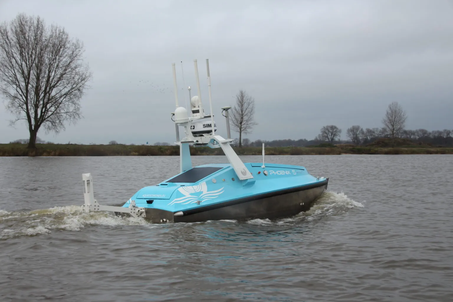
Phoenix 5 by Aquatic Drones
Deep Trekker provides fully assembled, tested, and ready-to-use industrial-grade submersible robots for complex underwater missions to perform regular net inspections, fish feeding monitoring, and husbandry. Deep Trekker ROVs and Pipe Crawlers are widely used for wastewater and stormwater inspections as well as for emergency scenarios or inspections in remote or confined spaces.
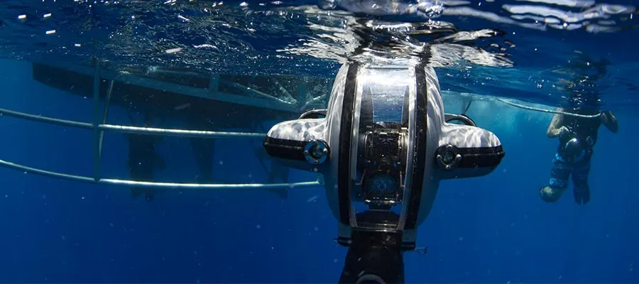
DTG3 ROV by Deep Trekker
Risk of natural disasters, proactive monitoring of disasters
When teams operate in dangerous environments such as during a natural disaster or its aftermath, UAVs are used to save the lives of first responders and tactical teams. Unmanned aerial vehicles can access hard-to-reach places faster, cheaper, and with less risk than manual inspections. In this category, companies feature their heavy-lifting potential, durability, flight duration, and ability to operate in harsh environments.
The SDO 50 V2 of SwissDrones is capable of providing real-time data and visual information in case of natural disasters such as wildfires, earthquakes flooding, or hurricanes to help first responders and civil protection organizations with better situational awareness. It is a unique twin-rotor aircraft designed to replace manned helicopters at reduced costs, significantly lower carbon emissions (up to 95% lower), and without putting crews at risk when operating in challenging weather conditions.
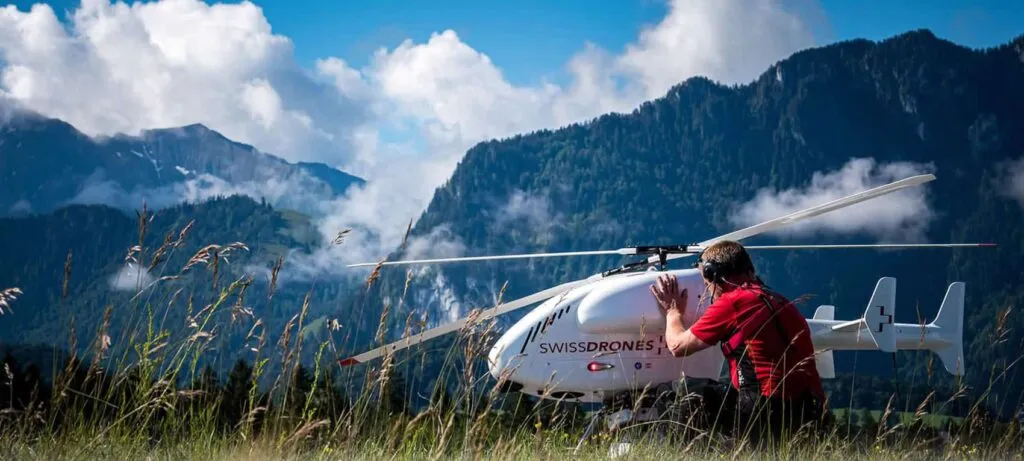
SwissDrones SDO V2
For extreme heavy lifting and long flight duration, Parallel Flight Technologies’ Firefly aircraft can lift its own mass in payload, not including fuel, for over two hours. It is also fully redundant and can continue flying in the event of an engine failure. This opens new possibilities for unstaffed logistics, search-and-rescue, firefighting, and heavy sensor applications.
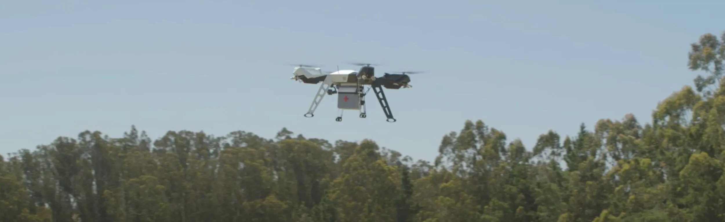
Parallel Flight Technologies UAV
The Drone America’s NavX and NavX Tactical are based on a rugged, mid-sized, modular eight-rotor platform. Capable of carrying modular payloads up to 10 pounds while operating at high altitudes and in 25 mph winds, the NavX system has proven it can deliver during the most critical missions.
Emesent’s flagship product, Hovermap - ZOE, is a smart mobile scanning unit that combines advanced collision avoidance and autonomous flight technologies to map hazardous and GPS-denied environments. Its award-winning technology utilizes innovative hardware, advanced algorithms, and machine learning to automate the collection and analysis of the physical world (6).
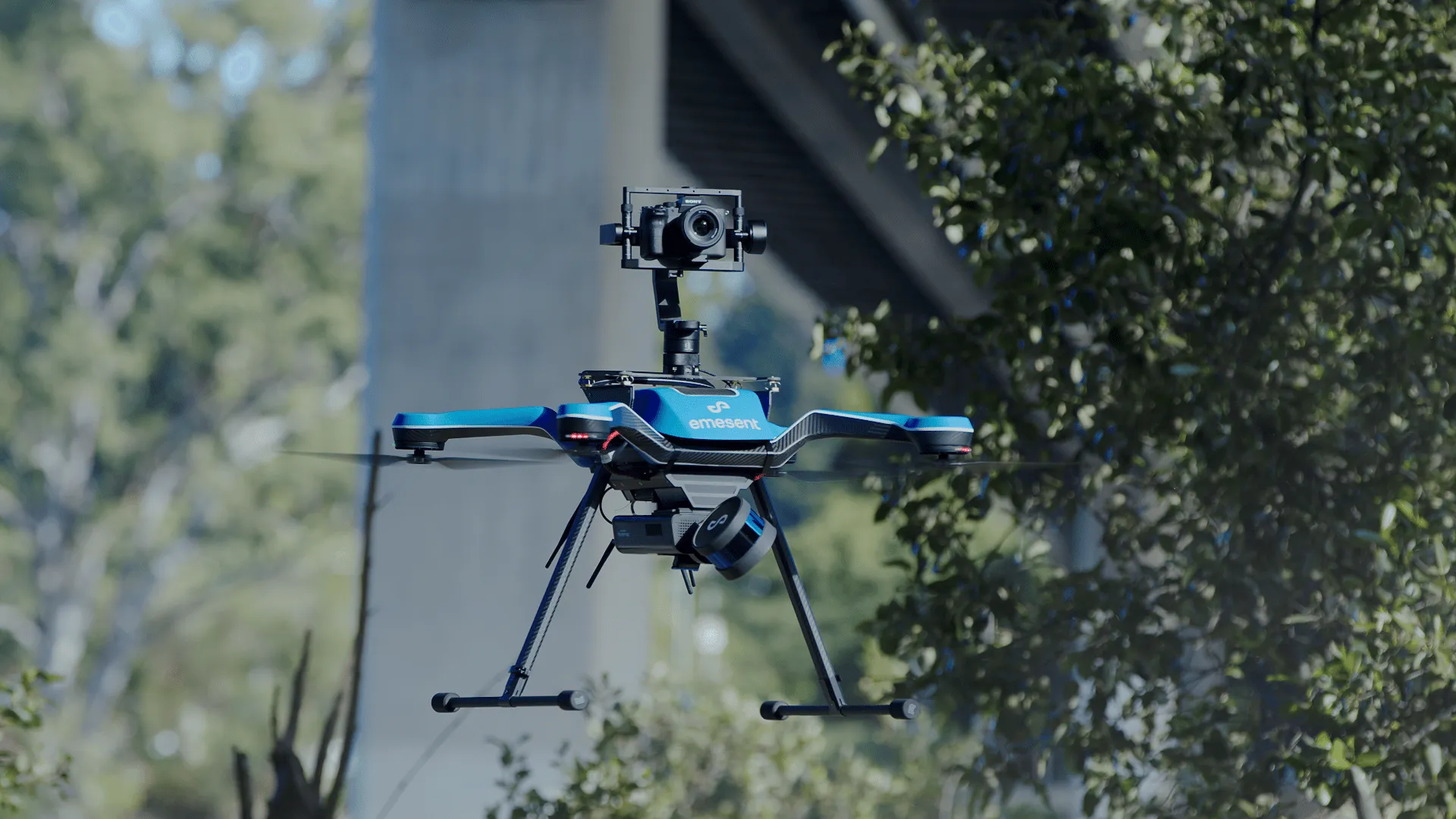
Hovermap - ZOE by Emesent
Storm tracking and forecasting
Weather UAVs offer a major advantage in collecting weather data. Weather drones have maneuverability, can be flown at high altitudes of over 1 km (3500 ft), and can fly directly into the wind & storms to obtain data for a specific location at a specific altitude. They are equipped with sophisticated sensors to facilitate such weather metrics as temperature, humidity, and wind in real time. The weather forecasts based on this data are crucial for air traffic operations at airports, tornadoes or hurricane warnings, and climate change research among others.
Meteomatics develops weather drones that can reach an altitude of 6 km and have a deicing function for propeller blades to shake off the ice in temperatures below 0°C and adapted propellers to withstand high wind speeds and provide improved flight capability and reliable operation.
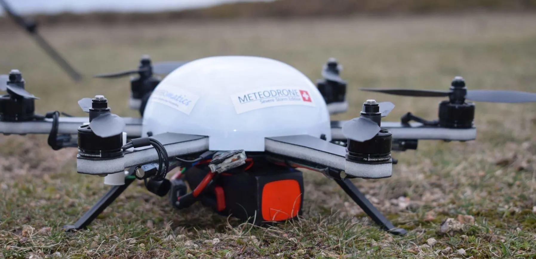
Meteomatics’ weather drone - Meteodrone
On September 30, 2021, Saildrone’s SD 1045 encountered Category 4 Hurricane Sam approximately 450 nautical miles NE of Puerto Rico. The vehicle remained in the storm for several hours, experiencing winds gusting over 120 mph and 50+ foot waves, and sent near-real-time data and video throughout the storm to Saildrone Mission Control. As a result, the scientists learned that fresh (low saline) water, likely coming from the Amazon River, may have fueled Hurricane Sam, keeping the ocean surface warm and allowing for more evaporation of energy.
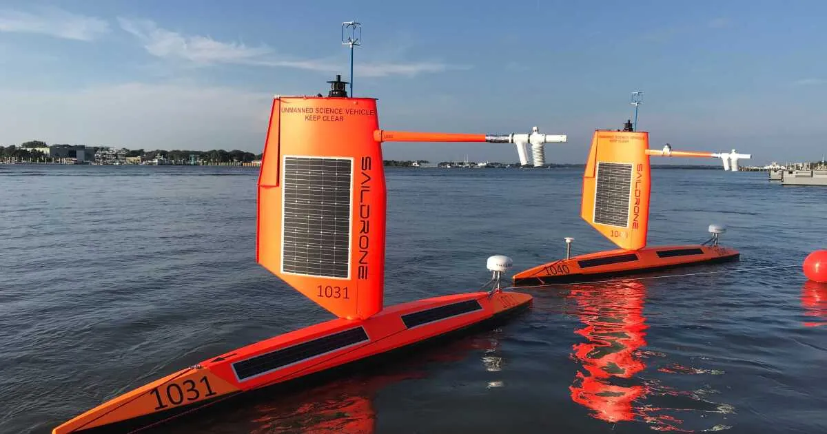
Saildrone’s vehicle Explorer
Search and Rescue Operations
Every minute counts in Search & Rescue (SAR) operations for missing people. Drones can hugely facilitate the search and cover wider areas faster than tactical teams on the ground. Visibility, fast deployment, and detection mechanism including thermal detection are prime features of SAR-specific UAVs. Another benefit is that UAV deployment is much cheaper than using a helicopter.
Aerialtronics fast deployment solutions are equipped with infrared sensors to maximize the ability to spot individuals in distress. With real-time, augmented people and object detection capabilities, their UAVs allow them to search an entire landscape with drones for a fraction of the cost of helicopters.
Autel Robotics produces an EVO II Pro V3 UAV that is equipped with Sony's new 20-megapixel 1-inch CMOS image sensor for clear vision, a noise reduction mechanism that enables pilots to provide support in operations with minimal lighting or at night. With 19 groups of sensors, including 12 visual sensors, the main camera, and ultrasound, EVO II Pro V3 can build three-dimensional maps and plan paths in real time which makes it a reliable solution for search and rescue.
Although the technology is getting better, using UAVs for SAR has limitations - such as clarity of images of the scene, accuracy, and false positives making it difficult to conduct a precise operation. Furthermore, to have a successful mission with UAVs. teams have to undergo a lot of training and procedures and can take a long time to execute the mission. In a densely forested area, even the best drone will have major difficulty locating a missing person even with a visual or thermal camera.
Geospatial Mapping and Operations Support
UAVs offer a more efficient alternative to traditional GPS mapping tools. Aside from the time and money saved, drones can map out vast patches of land autonomously without exposing teams to unforgiving conditions.
CarteNav, backed by Lockheed Martin, develops C4 & ISR Mission Software - a highly adaptable robust software for meeting today's diverse operational requirements like multi-sensor control, geo-referenced moving maps, evidence reporting, SIGINT, custom mapping, and more.
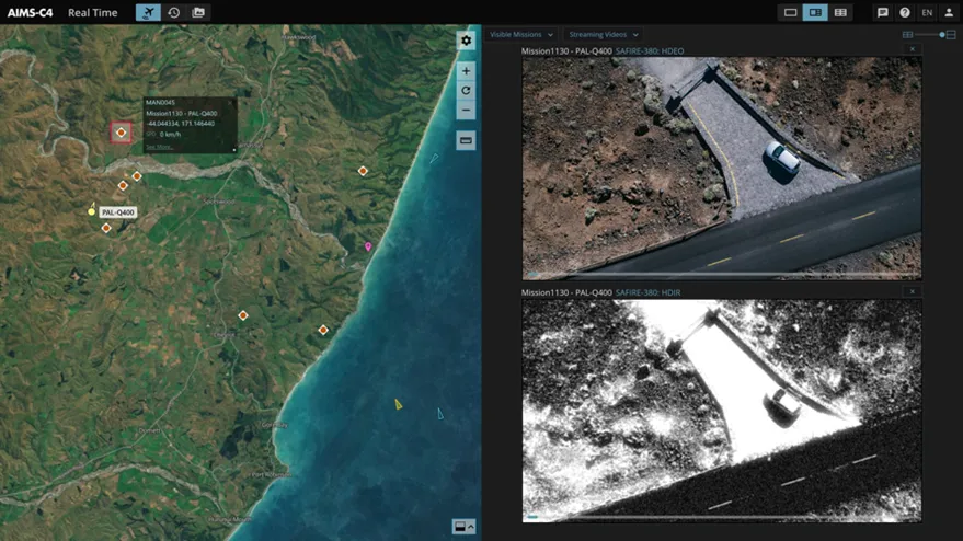
AIMS-C4 Mission Software by CarteNav
Quantum Systems produce the eVTOL fixed-wing mapping drone for professionals. After Cyclone Harold hit Fiji, the Trinity UAV provided aerial mapping imagery to assist UN relief efforts to locate damaged and destroyed rooftops, fallen trees, blocked roads, and river flooding.
Wildlife Monitoring, Poaching
UAVs are invaluable in surveying wildlife by:
- Helping detect and prevent poaching;
- Monitoring animal count and location;
- Identifying unusual trends in the behavior or health of animals;
- Discerning and fixing animals trespassing into agriculture fields.
Some drone companies are even working on remote delivery of anesthetic darts into larger wildlife species and remote net launcher systems to capture birds and mammals.
While UAVs impact is invaluable in this niche, there are some limitations. One of the biggest concerns is that UAVs can disturb animals with their presence, especially easily disturbed species. Yet drones are still one of the least invasive methods to track and count wildlife, especially when compared to radio-enhanced collaring. Some other limitations include local aviation regulations that restrict the use of UAVs at certain altitudes and at night.
Rhino poaching numbers have escalated in recent years as the demand for rhino horns in China and Vietnam continues, and various methods have been trialed in a bid to combat poaching. Hidden cameras, GPS tracking, satellite imagery, predictive analysis, and hidden cameras have all been used by gamekeepers, but the method that consistently has the best results is the use of drones. We need to spot the poachers before they spot us, otherwise, they will ambush us (4).
A company Superwake is currently in the process of carrying out +1000 km sq. projects with various conservation agencies throughout Canada and the United States to iterate and improve their technology. By flying day and night, their solar + electric drones can provide Intelligence, Surveillance, and Reconnaissance (ISR) at a rate comparable to manned aircraft. They can also deploy multiple drones simultaneously to collect the data needed within a short window including in freezing and windy weather. They are currently trialing infrared cameras that can discern age and sex characteristics (e.g. antlers, throat bells, and body size) through thick canopy cover, without the need for ground snow (7).
Superwake UAV - SW-96 RPAS
The Drone Bird Company is leading the world in the development of bird-shaped drones. They specialize in the development of fixed-wing and flapping-wing systems to solve pest bird problems in a non-lethal way with our flapping-wing falcon. Its unique feature is its ability to chase birds away in the direction of choice out of harm’s way, without habituation. Their AVES Series Larus model is the ideal drone for covert surveillance as it is virtually undetectable and indistinguishable from the real bird, for both humans and animals. AVES is quickly gaining interest from police, special forces, secret services, and military services from all over the world because of its unique flying platform. It is also ideal because of its modular payload, and because it can be modeled after any species most common to the client’s region, anywhere in the world (8).
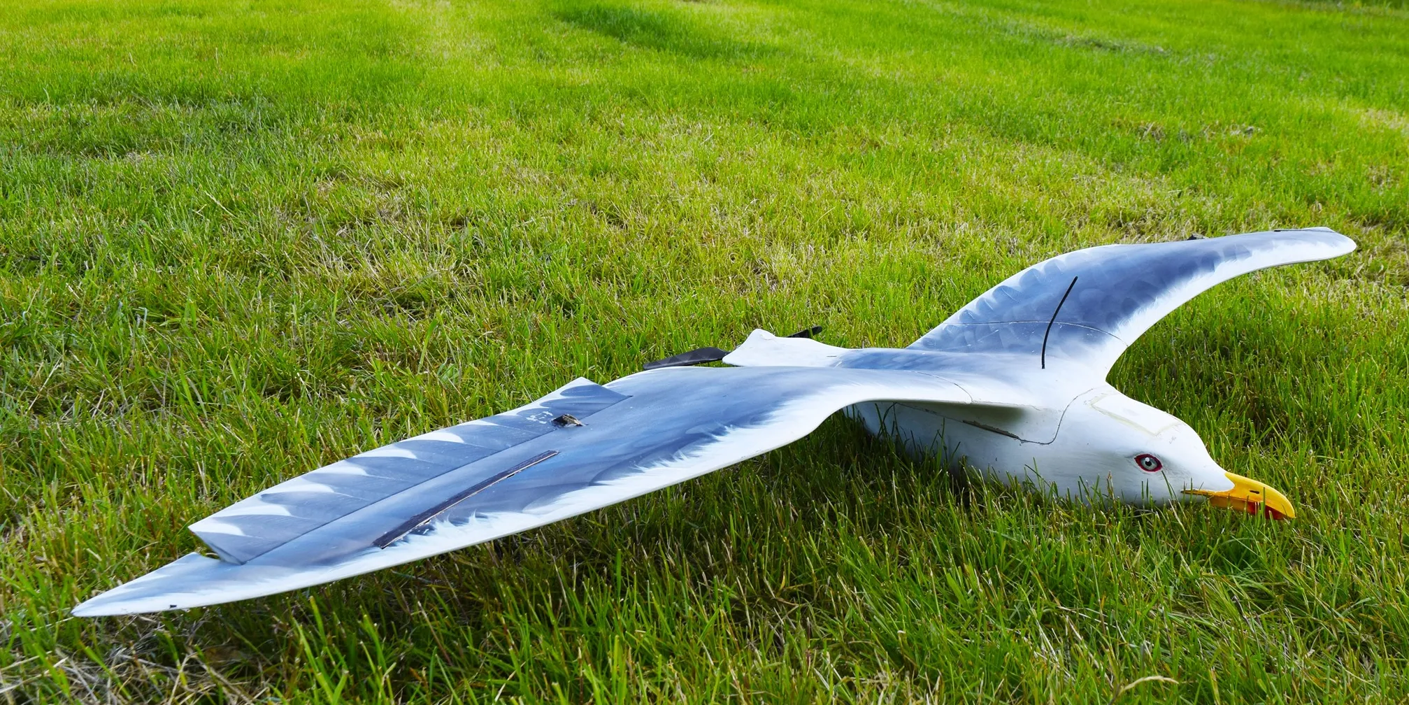
AVES Larus by Drone Bird Company
Damage by wild animals to cultivated fields is the main cause of profit loss for farmers in Europe, causing an average loss of 20% of harvests. Flox UAV’s can detect the various species present in the field day and night, and keep them away in an animal-friendly way.
Environment protection
UAVs are often used for monitoring air / land / maritime systems to observe environmental safety, more specifically for radiation detection, air pollution monitoring, forest fires prevention, and advanced wildlife protection and conservation.
A case in point is Atmos’ Marlyn UAV covers areas as large as 150 ha (370 acres) per flight, massively reducing your survey time. In addition, Marlyn is a one-time cost, resulting in a much cheaper option per Ha than manned-aircraft options. With Multispectral as well as Radiometric Thermal data, Marlyn is capable of seeing beyond the visual, providing new insights into plant health, animal behavior, and more, that were previously thought impossible. Marlyn provides total coverage of your particular area, including millions of individual & accurate data points. This allows you to glean a variety of data to both monitor and provide corrective actions to your study area.
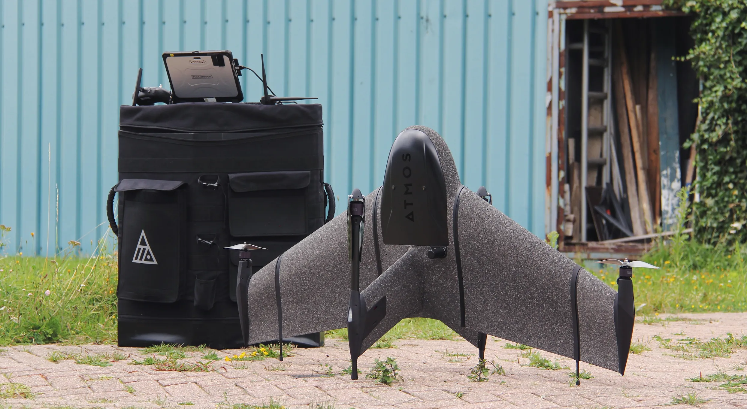
Marlyn by Atmos
Innovation landscape and a list of active players
In the innovation landscape and in the table below, we’ve collected a list of active UAV companies in their respective categories, their funding amount, and the investors backing them.
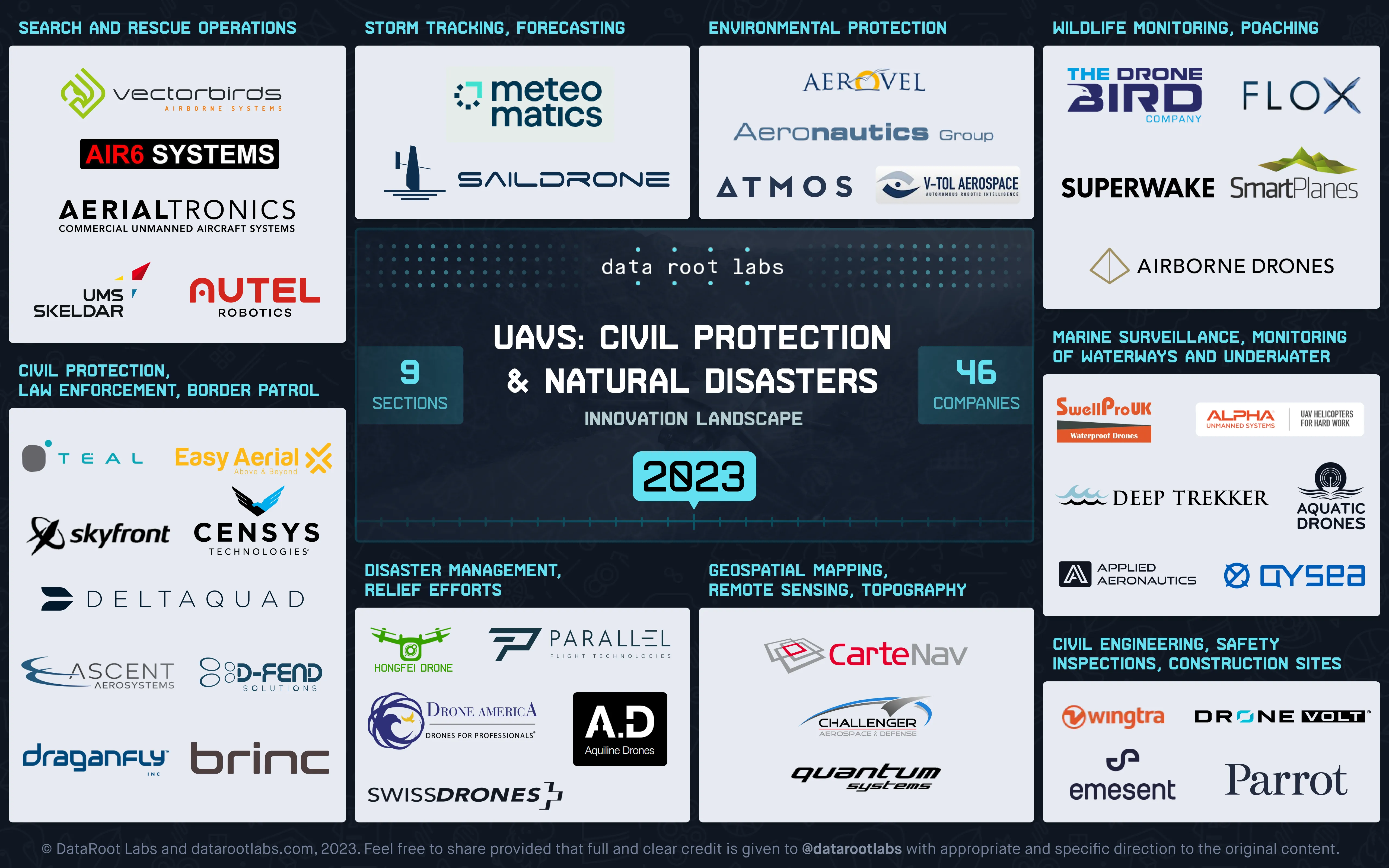
UAVs Disaster Management, Civil & Nature Protection Innovation Landscape 2023 by DataRoot Labs
| Company | HQ / year founded | Amount Raised, $ | Investors | What they are doing |
| AerialTronics | The Netherlands / 2011 | $9M / Corporate Minority | Aquiline Drones | Aerialtronics (part of Drone Volt group France) is an end-to-end solution developer that utilizes drones, artificial intelligence, and IoT data to provide businesses with augmented and actionable insights for Safety & Security, Inspection, Surveying & Mapping. They offer customizable unmanned systems that enable businesses to easily survey, inspect and analyze aerial data in real-time. |
| Aeronautics Group | Israel / 1997 | $20M | Rafael Advanced Defense Systems | Aeronautics Group is a leading developer and manufacturer of defense solutions based on UAS and advanced ISTAR systems. Aeronautics’ UAS line of products enable the military, homeland security and law enforcement customers to ensure the safety of millions of people. |
| Aerovel | USA / 2006 | $2.5M / B | United States Department of Defense, Defense Advanced Research Projects Agency, Office of Naval Research (ONR) | Aerovel is developer of an unmanned aerial system designed to offer reliable long-range imaging. The company's aerial system is designed to be used for marine and terrestrial applications and can operate from small spaces with little support equipment for aerial imaging, surveying, and broadcasting as well as target tracking, enabling clients to receive high-quality and affordable imaging. |
| AIR6 SYSTEMS | Austria / 2017 | - | - | AIR6 SYSTEMS provides drones for surveying, power distribution, wind energy, oil & gas, agriculture & forestry, and emergency services. The company is a supplier of 1) turnkey DRONE SYSTEMS - series production with a high degree of customization for special applications and in particular of 2) drones for HEAVY PAYLOADS. The latter allows a variety of professional applications, the simultaneous use of multiple sensors, and long flight times. |
| Airborne Drones | South Africa / 2013 | - | - | Airborne Drones designs and manufactures its own commercial drone systems in Cape Town with applications in Surveillance and Security, Natural Disasters, Wildlife and Game among others.
|
| Alpha Unmanned Systems | Spain / 2014 | - | - | Alpha Unmanned Systems is a leading developer and manufacturer of fuel-powered Helicopter UAVs: the ALPHA 800 and ALPHA 900. Fully autonomous, both helicopter UAVs fly longer and carry more weight than similarly sized UAVs (below 25kg MTOW). Used in more than 8 countries, Alpha’s helicopters can take off and land on moving vessels as well as traditional landing sites. Alpha is committed to designing and building helicopter UAVs that are reliable and versatile. |
| AltiGator | Belgium / 2008 | - | - | AltiGator's aim is to design and build safe, efficient, reliable, and tailored drones for any kind of professional application. AltiGator developed its own range of drones and stabilized camera gimbals, registered under the OnyxStar brand, certified by the DGAC (French civil aviation authorities), the DGAT/DGLV (Belgian civil aviation authorities), and in other countries. |
| Applied Aeronautics | USA / 2014 | - / Seed | - | Applied Aeronautics is a US-based UAV manufacturer, specializing in affordable, long-range composite solutions. Applied Aeronautics’ flagship product, The Albatross, is an electric, fixed-wing UAV designed for most industries, ranging from agriculture and research to disaster management and defense. This entirely customizable solution was engineered for accessibility, to meet the growing demand for a professional UAV that delivered robust capabilities at an affordable price point. |
| Aquatic Drones | The Netherlands / 2016 | $494k / Grant | Eurostars SME Programme, Interreg Baltic Sea Region | Aquatic Drones develops innovative Autonomous Surface Vessels for monitoring and inspection of waterways, ports, coast and offshore. The company provides Triple Technology including aquatic drones that collect data autonomously, multi-use surface vessels with a wide range of sensors and Maritime Predictive Maintenance Software. |
| Aquiline Drones | USA / 2018 | $2.06M / Seed | - | Aquiline Drones specializes in autonomous drone services for asset inspection, surveying and mapping, videography, perimeter security, law enforcement, and more. The company's technology uses AI and a specialized cloud to control drones and offers full-service, UAV solutions with equipment, personnel, and cloud infrastructure for a multitude of use cases, enabling governments, businesses, and private individuals to elevate the safety and privacy standards, fostering a responsible use of drones in the society. |
| Ascent AeroSystems | USA / 2014 | $1M / Crowdfunding | Genius NY | A Global Leader of Coaxial UAV Drone Technology, Ascent AeroSystems offers compact, all-weather, high-performance UAS designed and built in the USA. Durable, modular, and based on proven coaxial technology, they are the ideal platforms for mission-critical operations in government, military and defense, public safety, and enterprise operations. Their UAVs feature an Open Architecture Platform designed to easily be upgraded as new sensors become available. |
| Atmos | The Netherlands / 2013 | - / Seed | Disruptive Technology Ventures. | Atmos is developer of industrial mapping drones designed to empower professionals across all industries to effortlessly gather geospatial data from the skies. The company's drones offer aerial mapping, surveying, and 3D model generation by measuring distances and performing volumetric analyses, enabling clients to map areas faster with less equipment damage and make more informed decisions, efficiently and effectively. |
| Autel Robotics | USA / 2014 | - / Seed | Tongcheng Zichan, China Securities | Autel Enterprise Robotics provides aerial robotics to the public sector, public safety, enterprise, and commercial operations. Offering the highest resolution thermal imaging available to the civilian market, the current EVO II Series aircraft are purpose-built for automated and manual flight in law enforcement, fire, security, inspection, mapping, survey grade-capable data, with ingrained data security. |
| BRINC | USA / 2019 | $27.2M / A | Index Ventures | BRINC builds drones and technology in the service of public safety designed to respond to emergencies in seconds and succeed the police helicopter. This system would create a distributed network of drones in multiple locations to aid first responders when lives are at risk. In addition, BRINC is developing drones for industrial use cases that are dangerous for people. |
| CarteNav | Canada / 2002 | $1.4M / Undisclosed | Lockheed Martin | CarteNav develops ISR Mission Software for security, safety, economic, and environmental operations. Some of the critical missions their customers execute daily include SAR, maritime patrol, aerial firefighting, border security, oil spill recovery, law enforcement, wildlife monitoring, and more. CarteNav Solutions was acquired by PAL Aerospace on August 8, 2016. |
| Censys Technologies | USA / 2017 | $12M / A | Kirenaga Partners, Collective Capital Ventures | Censys Technologies develops an UAS with BVLOS capabilities - flying an UAS without a remote pilot having to keep it in visual sight. Its remote sensing streamlines the flow of data from acquisition to action. The system is being designed to support other UAS service companies, agriculture, and the petroleum industry, all done in ultra-high resolution. |
| Challenger Aerospace & Defense | USA / 2009 | - | - | Challenger Aerospace is a conglomerate of multiple companies focused on providing the best-unmanned systems to our customers. These currently include AeroComputers, Challenger Precision Machine, Challenger Mission Systems, Challenger Flight Systems, Challenger Training, and Support, Challenger Aerospace: Dragon Works Team, Challenger Marine Systems, and Challenger Ground Systems. |
| D-Fend Solutions | Israel / 2017 | $28M / D | Claridge Israel | D-Fend Solutions is the leading counter-drone takeover technology provider, enabling full control, safety, and continuity during rogue drone incidents across complex and sensitive environments, to overcome both current and emerging drone threats. With hundreds of deployments worldwide, EnforceAir, the company’s flagship offering, focuses on the most dangerous drone threats. EnforceAir autonomously executes RF, cyber-takeovers of rogue drones for a safe landing and outcome, ensuring the smooth flow of communications, commerce, transportation, and everyday life. |
| DeltaQuad | The Netherlands / 2012 | - | - | DeltaQuad (a registered trademark of Vertical Technologies) is a pioneer in electric long-range VTOL UAVs. It is the first electric Fixed Wing VTOL UAV to cover 100 km with a 1 kg payload in one single flight. |
| Drone America | USA / 2009 | - | - | Drone America’s Unmanned Aircraft Systems (UAS) are primarily developed for disaster relief, humanitarian aid, and emergency response. |
| Drone Volt | France / 2011 | $4.39M / Post IPO | - | DRONE VOLT is an international leader in the field of professional civilian drones and embedded artificial intelligence. With its 3 brands, DRONE VOLT, AERIALTRONICS, and DANDRONE, the Group is always developing more innovative solutions for the energy, construction, civil engineering, and security industries for applications such as inspection, surveillance, surface treatment, thermography, search and rescue missions. |
| Easy Aerial | USA / 2015 | $11.2M / A | Closed Loop Fund | Easy Aerial is developer of a smart aerial monitoring system designed for perimeter security. The company's system consists of lightweight drones that can carry various payloads for extended flight time, a mobile and self-sustaining ground base station that charges and provides comprehensive weather protection, and a fleet management software that delivers live and thermal video feed, enabling clients to monitor data in real-time, enabling clients to monitor data in real-time. |
| Emesent | Australia / 2018 | $25.5M / A | Archangel Ventures, Main Sequence Ventures | Emesent is a world leader in drone autonomy, LiDAR mapping, and data analytics. Their flagship product, Hovermap, is a smart mobile scanning unit that combines advanced collision avoidance and autonomous flight technologies to map hazardous and GPS-denied environments. Its award-winning technology utilizes innovative hardware, advanced algorithms, and machine learning to automate collection and analysis of the physical world. |
| Flox Robotics | Sweden / 2020 | - | Swedish Board of Agriculture | Flox aims to support stakeholders in the areas of agriculture, forestry and infrastructure that want to adopt sustainable, cost-effective solutions for coexistence with wildlife that leads to everything from increased agricultural production by preventing food loss to collision avoidance with vehicles. Flox helps you to sustain certain human livelihoods and preserve particular species at the same time. |
| Heliguy | UK / 2006 | - / Grant | SAM Project | heliguy™ is a one-stop drone shop, supplying and supporting UAS programs around the world.
heliguy™ provides counter-UAS technology, including a layered drone defence solution; and also has an in-house R&D lab, specialising in industrial grade 3D printing and product manufacturing for the drone industry. |
| Meteomatics | Germany / 2012 | $14M / B | Alantra | The focus of Meteomatics lies on the development of meteorological software products, processing and providing weather data and consulting work. As a flying weather station, the Meteodrone, developed by the company, collects data to provide extremely precise information on temperature, humidity and wind in the lower atmosphere can be recorded. |
| Parallel Flight | USA / 2018 | $10M / Private | StartEngine Crowdfunding | Parallel Flight Technologies is an industrial-grade drone company with a mission to deliver unmanned systems that save lives, property, and the environment. The startup company has developed patent-pending drone technology that will allow drones to carry heavy payloads for over two hours, making it ideal for use in fighting wildfires, search and rescue, healthcare and other mission-critical logistics applications. |
| Parrot | France / 1994 | $36.1M / Corporate Minority | Horizon, IDG Capital | Parrot provides best-in-class technology for inspection, first responders, firefighters, search-and-rescue teams, security agencies, and surveying professionals.
|
| Quantum Systems | Germany / 2015 | $50M / Series A | 10x Group, BayernKapital, Project-A, Thiel Capital | Quantum-Systems specializes in the in-house development, design, and production of small UAV. Their drones combine long reach and electrical efficiency with the ability to VTOL without additional equipment. They integrate high-precision sensors into the systems for increased aerial data intelligence. |
| Saildrone | USA / 2014 | $180M / C | Bond, Crowley Maritime | Saildrone is a provider of ocean data collected by a fleet of unmanned, autonomous sailing drones. The company is enabling an open systematic view of the earth's oceans and pioneering a new wave of applications providing insight and access to real-time data. Saildrone is democratizing access to the oceans, which remain largely unexplored, and is poised to revolutionize the industry. |
| Skyfront | USA / 2014 | $2.7M / Unknown | Acorn Pacific Ventures, Chaac Ventures | Skyfront builds hybrid-electric drones that fly for 5 hours, a 10X improvement over battery-powered drones, for use in long-range infrastructure inspection, surveillance, and SAR missions.
Perimeter drone holds the unofficial world record for endurance among commercially available multirotors. Off the shelf, it can fly for 5 hours and carry up to 10 kilograms of payload, all while maintaining the same simplicity and ease of use that made the multirotor popular in the first place.
With the Perimeter, missions that used to take days can now be performed in a single flight, enabling entire industries to scale their drone operations with ease. |
| SmartPlanes | Sweden / 2005 | - / Growth Equity | Inlandsinnovation, Partnerinvest Norr, Ackra Invest, Almi Invest | SmartPlanes is manufacturer of commercial drones designed to offer surveying, mapping, city-planning, mining, forestry, agriculture, volume calculations, science, and wildlife protection services. The company's drones use aerial geomatics, geospatial technology, equipment platform for georeferenced orthophotography, and 3D modeling, enabling clients to quickly survey large areas with very high precision. |
| Superwake | Canada / 2019 | - | - | SUPERWAKE's technology enables population counts of species over large areas with accuracy and costs better than any current solution. Equipped with electro-optical and infrared cameras, their drones can capture accurate and reliable data systematically. |
| SwellPro | China / 2015 | $737K / Crowdfunding | - | SwellPro is a developer of waterproof drones designed to provide professional filming, drone fishing, and action filming. Their waterproof drone comes with a fully waterproof quadcopter frame and waterproof motors, and can carry a gimbal camera for smooth video in the air and underwater, or carry a payload release mechanism to deliver items from A to B. |
| SwissDrones | Switzerland / 2013 | $15M / undisclosed | Boundary Holding, DiamondStream Partners | Manufacturer and operator of long-range UHS, SwissDrones enables safe and cost-effective unmanned aerial intelligence solutions for surveillance, inspection, and SAR missions BVLOS. SwissDrones’ unique twin-rotor UHS are designed to replace manned helicopters at reduced costs, significantly lower carbon emissions and without putting crews at risk when operating in challenging conditions. |
| The Drone Bird Company | The Netherlands / 2012 | $5.63 M / Spinout | Cottonwood Technology Fund, Delft Enterprises | The Drone Bird Company specializes in bird-shaped drones - fixed-wing and flapping-wing systems. Their drones are both available for purchase or as a service provided by specially trained pilots. |
| UMS Skeldar | Switzerland / 2015 | - | CT Equity & Advisory | UMS SKELDAR is Europe’s leading provider of Rotary Unmanned Aerial Vehicle (UAV) platforms including the unmatched NATO-compliant rotary SKELDAR V-200 and the smaller V-150 designed to support tactical operations for surveillance, emergency response, homeland security, and defence. |
| V-Tol Aerospace | Australia / 2004 | - | - | V-TOL’s aim is to establish an Australian hi-tech strategic robotics sector that directly supports the Nation’s ‘core’ economic industries such as mining & energy, agriculture & fisheries, forestry & environment, construction & infrastructure, education, tourism & government services. V-TOL is a supplier of S-UAS technology, training & flight services to over 7 countries & global organisations, such as the World Bank and Hitachi. |
| VectorBirds | Germany / 2019 | - | - | VectorBirds is an innovative development and production service provider with bundled expertise for air platforms and special UAV solutions. They focus on production of multicopters and helicopters for industry, government agencies, and research, both as small series and individual products. |
| Wingtra | Switzerland / 2016 | $15.6M / A | Credit Suisse Entrepreneur Capital, Verve Ventures | Wingtra is the world's leading VTOL drone producer. The WingtraOne simplifies how aerial data is collected. It is as agile as multicopters and has the flight capability of a fixed-wing aircraft regarding range and speed. It opens new possibilities for improving wildlife protection, agriculture, parcel delivery, and many other applications. |
| xCraft | USA / 2013 | $2.1M / Equity Crowdfunding | StartEngine, Meyer Global Management | xCraft is developing UAV's which enable both precision landing and hovering capabilities and efficient long-range flight. The company is also developing UAVs that enable users to turn their smartphones into drones as well. Their flagship product, the X PlusOne is a transitional VTOL aircraft capable of vertical takeoff and landing as well as high-speed flight using its patent-pending hybrid multi-rotor flying-wing design. |
Remaining Challenges and Final Thoughts
With a clear set up of benefits, UAVs penetration of various industries will only accelerate. That said, a general set of challenges remain.
- Safety over flying unmanned aircraft in civilian airspace and densely populated areas;
- Personal privacy concerns of civilians who do not consent to appear in footage;
- Reliance on wireless communication makes UAVs prone to various attacks: UAVs can be hijacked and manipulated;
- Malicious use of drones by criminals opens new tactics that need to be countered;
- “Dehumanising” effect on treating civilians, especially during border control;
- Legislation in different countries restricts and limits the usage and research of UAVs;
- Technical limitations of drones such as flight time, payload, sensors, connectivity, and many others depending on a use case.
As technology gets better and more mature, most of the challenges will be managed more effectively. We expect to see more players entering the market, increased funding, and more industry-specific applications of drones. Finally, it is important to highlight that UAVs are not to be expected to solve all issues of a given industry or to replace humans. In most settings, they provide invaluable assistance but do not the replacement of human teams.
Sources:
(1). Unmanned aircraft systems (UAS)/drones registered in the United States.
(2). PwC report supports UK government drone strategy, predicts 900,000 drones by 2030.
(3). Military Equipment Use Policy.
(4). 2022 U.S. Drone Manufacturers - Comprehensive List.
(5). Drone surveillance for wildlife and game reserves.
(6). Airborne Laser Scanning > Hovermap.


Author
Co-Authors