Skies of Change: UAVs in Energy, Mines, and Resources Management
Exploring use cases, benefits, and limitations of drones in renewables, construction, mining, telecommunications, oil & gas, agriculture, and forestry.

As part of our ongoing commitment to covering the advancements in this field, DataRoot Labs is thrilled to present the second installment of our research series. In this issue, we specifically explore the role of Unmanned Aerial Vehicles (UAVs) in energy, utilities, critical infrastructure, oil & gas, agriculture and forestry. Our research features the use cases of UAVs, list of active players and rising startups, investments, and highlights current challenges and limitations. To view the first research on UAVs for catastrophes and natural disasters relief, wildlife protection, civil protection & law enforcement, click here.
In addition to being a critical and proliferating reconnaissance and attack instrument, Unmanned Aerial Vehicles (UAVs) have emerged as transformative tools with diverse applications across industries including critical infrastructure and resources management covered in this report. As we navigate the skies of change together, let’s look at each industry category and explore the most interesting use cases before turning to investments and challenges.
Energy & Utilities
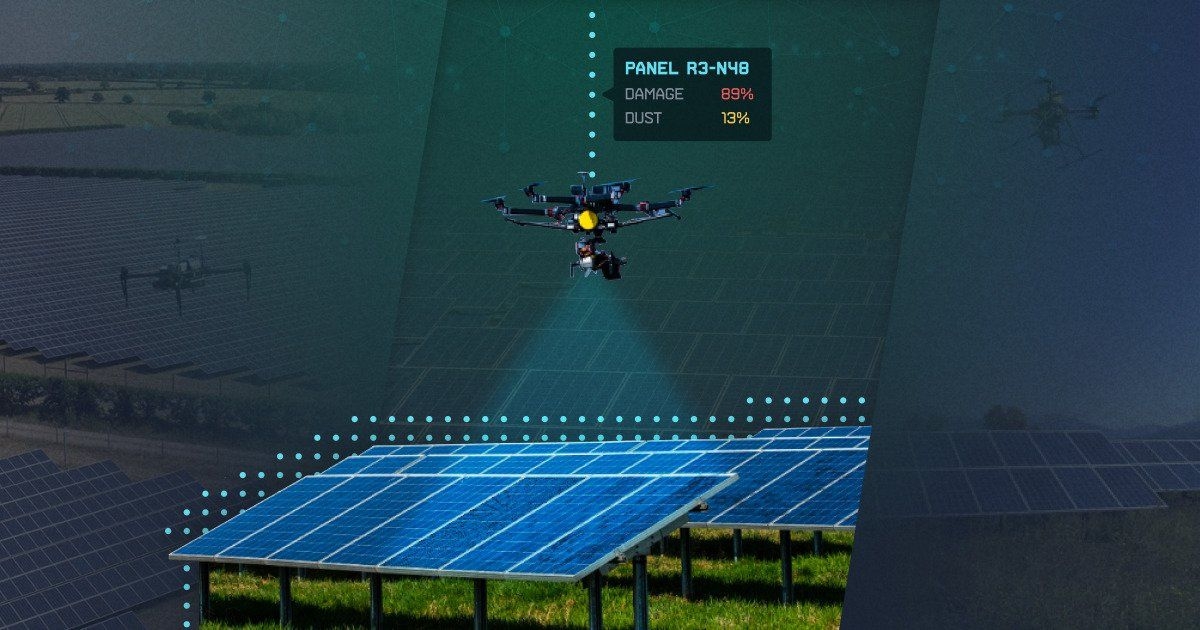
Solar Panel Inspection:
Continuous growth of the solar industry (Market Size worth $168B in 2021 and forecasted $370+B by 2029 with a CAGR of 6.9%) brings an ever-expanding base of solar installations. Quality assurance is vitally important for solar panels, as they are designed to last for 20 years.
Over time, solar panels may develop defects and can cause a severe drop in energy production and accidents if left unchecked. Also, their performance declines over time as solar cells degrade due to UV exposure, thermal cycling, access heat, and humidity at a rate of at least 0.5% per year. Due to cell and interconnection failure and physical degradation, cells can start producing heat energy instead of electrical energy.
Traditional solar field assessments consist of inspecting each panel with handheld thermal imagers to check for defective cells or cables. UAVs, equipped with high-resolution cameras and thermal imaging technology, make solar inspections significantly faster, cheaper, safer, more effective, and more precise. Here is a summary of the potential benefits of deploying UAVs for the solar energy sector:

For a particular use case, check out the IF1200A by Inspired Flight, a reliable, durable drone ideal for solar panel inspections. With a maximum payload of 19 pounds, it reaches speeds up to 51 MPH and provides a maximum flight time of 43 minutes even with a loaded payload. This drone ensures thorough inspections, allowing for adjustable altitude and customizable flight paths. It's recommended for its safety, efficiency, and affordability. Inspired Flight drones are American-made, NDAA compliant, Blue UAS certified, and approved for military use by the US government.

Inspired Flight IF1200A, heavy-lift drone, for Solar Inspection
Wind Turbine Maintenance:
The offshore wind market is projected to reach $56.8B by 2026 from an estimated $31.8B in 2021, at a CAGR of 12.3%.
Now that wind farms have larger portfolios, turbines are more complex, and downtime remains as costly as ever, modern wind turbines have more demanding inspection requirements, must optimize output, and identify any issues before they become costly problems. Maintenance and repair of wind turbines is a critical activity for wind power generation facilities. Despite their high investment cost, low operating cost, and minimal environmental impact, the performance of wind turbines directly impacts the value of electricity production.
Damage inspection of turbines has evolved from tower crane access, rope access, camera viewing, and other applications to manual drones over the years. This is where UAVs or drones come in as a more effective, faster, and safer option. From cheaper hardware to the rise of autonomous drone software, drone inspections have become more accessible for in-house teams, highlighting the advantages of insourcing this process. We summarize the advantages of employing UAVs for wind turbines on the following slide:

To explore a particular case, take a look at Alerion's WEGOOI inspection drone which, equipped with advanced technology, performs wind turbine inspections in under 15 minutes. The inspection includes damage assessment, repair recommendations, and the creation of digital twins using photogrammetry and LiDAR point clouds. The drone, with cameras and an edge device at the front, utilizes autonomous navigation and AI damage detection to identify and assess turbine damage. The 3D LiDAR laser ensures consistent alignment, crucial for accurate inspections. Local edge devices, running deep neural networks, combine information from LiDAR and high-resolution images to produce detailed 3D images. The AI damage detection software automatically identifies even micron-level damage in the turbine, eliminating the need for re-inspection.

Alerion's WEGOOI inspection drone
Power Lines, Utility Poles & Telecommunications:
Utility poles & communication towers are essential for our interconnected society, supporting electricity, cooms, and vital services. The global utility poles market reached almost $46B in 2021 and is projected to rise to around $70B by 2030, with a CAGR of 3.8% from 2022 to 2030.
Power line and telco tower assessments still traditionally rely on foot patrols, a slow and error-prone process, especially considering the vast number of local distribution systems in place. This method, involving thousands of workers, is time-consuming and risky due to the need for climbing gear and equipment. Drones automate grid inspections, ensuring timely repairs, mitigating safety risks, and minimizing downtime associated with infrastructure maintenance. To sum up, the benefits of UAVs are described here:

With vHive, you can effortlessly monitor thousands of kilometers of overhead power lines using autonomous drones, gaining a comprehensive view of your transmission lines, towers, and insulators. vHive’s advanced AI-based fault detection enables you to identify potential issues and receive timely, actionable insights to proactively address faults before they escalate, avoiding costly outages and ensuring maximum grid availability.

vHive’s AI-based fault detection for power lines and other energy assets
Hammer Missions provides specialized software for cell tower inspections, prioritizing precise mission setups for vertical operations. Utilizing Hammer's tower mapping feature, users can easily mark GPS points to generate automated flight paths, ensuring accurate tower capture with optimal distance and overlap. Additionally features like 'Circles' mode facilitate efficient imaging for towers of varying dimensions. Hammer's automatic gimbal adjustment streamlines the process by calculating optimal gimbal pitch based on drone height and tower distance. Furthermore, Hammer Hub enables seamless data management, allowing users to upload, process, annotate, and share drone data in 3D with stakeholders.

Cell Tower 3D Digital Twins by Hammer Missions’ Inspection Software
Agriculture
The global population growth presents a significant challenge for agriculture, requiring considerable time and investment. Drones are revolutionizing this sector by providing precise monitoring, spraying, sensing, and mapping capabilities. No wonder the autonomous drones sector within the global agriculture drone market is projected to grow rapidly, reaching approximately $2.2B by 2028, compared to $0.5B in 2020.
The benefits are numerous. Drones offer real-time insights into crop health, soil conditions, and irrigation, enabling early issue detection. Equipped with AI and machine learning, drones enable predictive analysis for sustainable farming. Their cameras and sensors facilitate rapid data collection, aiding quick decision-making by farmers.
By accurately applying resources like fertilizers, drones minimize waste and environmental impact, promoting crop growth. They contribute to eco-friendly farming by being flexible, cost-effective, and covering large areas. As drone technology advances, it promises to profoundly transform farming, enhancing efficiency, productivity, and environmental friendliness.

In Agriculture, Rantizo flew almost 200k acres in 2023 alone and managed the largest network of spray drone operators in the US. They enable industry-leading drone applicators by selling drones, software, support, and training services, and their platform connects demand for acres to be sprayed to local operators. Rantizo operators fly and apply in 35 states, providing qualified, licensed, and insured precision application services. With a 7.93-gallon spraying tank, their DJI Agras T30 takes aerial spraying efficiency to new heights, enabling more effective spraying, especially for fruit trees. Using DJI digital agriculture solutions, the T30 helps reduce fertilizer use and increase yield with effective, data-driven best practices.

DJI AGRAS T30 for aerial spraying
Hiphen designs plant imaging solutions for both indoor and outdoor, and custom-made image analytics applications tailored to tackle very specific agronomic challenges. PhenoScale is their ready-to-use solution to help access frictionless phenotyping with drones to help scale crop assessments and access phenotyping traits & outputs. PhenoMobile helps make ultra-precise plant assessments with very high-resolution imaging equipment. Ground-based phenotyping offers, at least, the ability to detect and quantify diseases and also to make early-season yield estimations. PhenoStation brings crop image analytics to greenhouses with a range of custom-made systems that adapt to specific conditions, with data that can be easily integrated into databases and management software.

Hiphen Plant Phenotyping and Crop Image Analytics Solutions
Mining, Quarries, and Aggregates
UAVs have become a staple in mining operations. The Drone for Mining Market was worth $1.18B in 2023 and is expected to reach $5.54B by 2030, with a projected CAGR of 22.6% from 2024 to 2030.
Drone mapping revolutionizes various aspects of mine operations, simplifying tasks from exploration to reclamation. It provides precise maps of rough terrain for excavation planning and enhances safety by identifying hazards. Drones monitor haul roads, inspect underground environments, and manage water movement, ensuring cost-effectiveness and safety. They offer detailed views of drill patterns and blasting results, enabling accurate volume measurements without risking personnel safety. Drone surveys also aid in preventing leaks and unexpected activity.

In this category, ISS Aerospace Beyond Visual Line Of Sight (BVLOS) drones are capable of capturing high-quality orthoimages by spanning entire mining operations faster and more economically than any other method. Each drone is equipped with high-resolution cameras which can be used for surveying purposes to create 3D maps of mining sites, helping companies to better understand the layout and composition of the reserves they are extracting. They are also used to inspect mining infrastructure such as pit walls, haul roads, or tailings dams and to provide detailed images and data on the condition of equipment. Sensors monitor mining operations, measure stockpiles, and emissions, and provide real-time data on factors such as ore quality or volume and movement to optimize production or detect potential problems. Additionally, drones are used to monitor potential safety hazards including rockfalls or unstable slopes without putting workers or staff in danger.

ISS Aerospace drone
Construction & Infrastructure
Advancements in drones and sensors are revolutionizing data collection and analysis in construction. The construction drone market has experienced rapid growth in recent years. It is expected to increase from $6B in 2023 to $12B billion in 2028, with a CAGR of 15%.
As the construction industry expands, the need for automation and intelligent technologies such as UAVs grows to boost efficiency, cut costs, and ensure safety. Unmanned aerial vehicles (UAVs), or drones, stand out as a key technology enhancing sustainability in construction and infrastructure.
In construction, UAV usage has surged by almost 240%, surpassing other commercial sectors. Hardware-wise, fixed-wing UAVs offer long endurance and range for large-scale mapping but require specialized training and infrastructure, whereas multi-rotor UAVs, like quadcopters, are highly agile and ideal for precise positioning but have limited range and payload. Hybrid UAVs combine features of both, excelling in versatile missions but are costlier and more complex to operate.
On the software side, UAV-based AI technologies offer specific advantages in construction software. These include enabling detailed 3D modeling of sites and structures for planning and measurements. They also facilitate non-destructive testing through thermal imaging and ultrasonic sensors to spot structural problems. Additionally, these technologies enhance safety monitoring and material inspection by using deep learning algorithms for object detection.

Let’s look at some use cases.
Field Group is a leading provider of comprehensive geomatic services, specializing in surveying, land acquisition, and building application services for the construction and infrastructure sectors. From land acquisition and legal support to cadastral surveys, Field's expertise extends to mobile mapping and geophysical services, employing laser scanners on cars to acquire detailed point clouds for 3D vector models. Their cloud-based software products, such as Mapspace and Fabriken, enable access and utilization of data, providing insights for planning, construction, and maintenance in the digital age.

Stake-out construction sites surveying by Field Group
Traditionally, the industry relied on divers for underwater documentation, but with the Blueye Pioneer underwater drone, construction companies can conduct their own efficient and cost-effective inspections. Operating in waters varying from shallow to open ocean (305m), their systems allow multiple data streams to be easily, rapidly, and safely captured, processed, and shared. The Blueye Pioneer, equipped with powerful LED lights and a full HD camera, excels in challenging underwater conditions, ensuring clear visibility even in poor water visibility. Construction projects near or in water, such as ferry lane and bridge construction, benefit from the drone's ability to conduct inspections, plan future work and verify completed projects.

Pioneer - BlueEye’s Underwater Robot
Oil & Gas
Drones play a crucial role in oilfield operations, especially in hazardous environments like deepwater platforms, and tasks such as monitoring methane emissions and repairing subsea pipeline leaks. The oil and gas drones market, valued at $3.7 billion in 2020, is forecasted to grow to $97 billion by 2032, with a notable CAGR of 31.3%.
The increasing adoption of drones in the oil and gas industry underscores their growing significance. They are utilized for inspecting offshore platforms, detecting pipeline leaks, emergency response, and more, and equipped with advanced sensors for visual, infrared, or LIDAR imaging. Recent advancements in drone technology have expanded their applications, from capturing images to sensing asset conditions like weathering and rust.

In Oil & Gas, TEKEVER, a leading drone technology company, has secured a contract with Phoenix Heli-Flight, a prominent Canadian helicopter charter company for the deployment of TEKEVER's AR3 UAS for monitoring and assessing critical oil and gas infrastructure. The AR3, equipped with a customized sensor package, is designed to conduct pipeline inspections in tandem with manned helicopters, effectively navigating challenging terrains and harsh environmental conditions. With an impressive operational endurance of 16 hours and a reduced logistics footprint, the AR3 offers an ideal solution for demanding missions.

TEKEVER's AR3 VTOL
Forestry
Forests account for a little over one-third (38%) of habitable land area and are crucial for the planet's well-being as the primary source of air for other ecosystems. Unfortunately, there is a lack of awareness of their significance. To address this, drone technology is actively used to enhance forest sustainability.
Drones offer a solution to the challenges faced by forests, including deforestation, urbanization, climate change, and biodiversity loss. With their capacity for aerial surveillance and efficient monitoring, drones play a vital role in wildlife conservation, providing valuable data on forest health and identifying areas at risk. This technology enables timely responses to threats like illegal logging and forest fires, contributing significantly to the preservation of essential ecosystems and overall planetary sustainability. UAVs tackle industry challenges by streamlining inventory management after harvest, enhancing safety in hazardous environments, and aiding regulatory compliance in forestry management, despite the significant costs involved.

AirForestry revolutionizes forest thinning with its aerial approach, using electric harvesting drones to minimize environmental impact. Unlike conventional 15-ton machines that damage plants, and roots, and cause mercury runoff, AirForestry's 6.2-meter diameter drones thin forests without ground disruption. The drones swiftly and precisely remove branches, leaving nutrients for forest growth. The process, controlled by an operator station, protects trees, soil, and plants, improving the overall forest environment and adjacent waterways.

AirForestry drone for forest thinning
Nordic Drones specializes in drone systems designed for efficient forest mapping and imaging. With extended flight times, their UAVs offer a seamless solution for imaging large areas, making the process both easy and efficient. The precision of their camera system ensures each tree is accurately placed on the digital forest map, facilitating detailed forest plans. Nordic Drones excel in analyzing challenging terrains and vast areas of up to 100 hectares. Their focus on long-flight drones enhances the accuracy of forest measurements, contributing to the overall efficiency crucial in the forestry sector.

GeoDrone6 by Nordic drones
Deep Forestry offers a fully autonomous drone that allows users to effortlessly measure their entire forest with just a push of a button. Capable of accurately scanning 1000 trees every 20 minutes, the drone provides comprehensive data on individual tree locations, species, height, diameter, trunk volume, curvature, and terrain type. This valuable information, generated with AI, aids in precision planning and optimization of profitability for harvesting and sawmilling operations. The drone creates a detailed 3D digital twin of the forest, enhancing visualization and decision-making.

3D digital twin of the forest by Deep Forestry
INNOVATION LANDSCAPE AND A LIST OF ACTIVE PLAYERS
Based on the public information gathered from Crunchbase, Pitchbook, and other open sources, we have compiled a list of companies and startups that build UAV hardware and/or software. They empower the mentioned industries and constitute today's UAVs in Energy, Mines, and Resources Innovation Landscape 2024.

UAVs in Energy, Mines & Resources Innovation Landscape 2024 by DataRoot Labs
In the table below, we’ve collected a list of active UAV companies in their respective categories, their funding amount, and the investors backing them.
| Company | HQ / year founded | Amount Raised, $ | Investors | What they are doing |
| ABJ Renewables | USA / 2015 | - | - | ABJ Renewables provides commercial drone solutions for the energy industry. The company provides services including thermal and optical imaging, 3D imaging, solar and wind farm inspections, law enforcement services including surveillance and pursuits, and commercial videography.
|
| Abyss | USA / 2014 | $13.5M / - | AirTree Ventures, Australian Retirement Trust | Developer of artificial intelligence-based software designed to improve the asset integrity campaigns of critical infrastructure.
|
| Acecore | Netherlands / 2013 | - | - | Manufacturer and developer of elevating drones intended to augment the commercial drone airspace and replace uninspiring, compromised tube frames for handcrafted elevated drones. The company offers services for lidar, mapping & surveying, inspection, security, creativity, and agriculture.
|
| AERIUM | Canada / 2016 | $4M / - | Clean Resource Innovation Network | Canadian-owned and operated UAV/RPAS service provider focused on data collection and processing, wildlife management, and geospatial intelligence with experience operating in complex environments.
|
| Aerocámaras | Spain / 2007 | $900K / Venture | Nexxus Iberia | Provider of drone training and aeronautical management services intended for professional drone pilots. The company offers drone pilot training and specialty courses for professional work such as technical inspections, emergencies, security, topography, precision agriculture, and audiovisuals as well as provides drone development and sales, enabling clients with drone certification and related service needs.
|
| AgEagle | USA / 2010 | $4M+ / Post IPO | - | AgEagle Aerial Systems Inc. is a provider of drone imagery data analytics for the precision and sustainable agriculture markets. It designs, produces, distributes, and supports technologically- advanced small unmanned aerial systems (UAVs) that it offers for sale commercially to the precision agriculture industry.
|
| AirForestry | Sweden / 2020 | $3.1M / Seed | Vinnova, Walerud Ventures, Länsförsäkringar | Developer of electric harvesting drone intended for forest management. The company's technology is used as a harvesting tool and to thin trees while contributing to reducing carbon dioxide emissions from forestry work while increasing the forest's ability to sequester carbon, enabling forest to grow and be able to store more carbon, which is vital in the fight against climate change.
|
| Alerion | Spain / 2014 | $2.1M / Venture | EASO Ventures, Orza Investments | Developer of navigation systems designed for fully autonomous and automated real-time infrastructure inspections. The company uses technologies for wind turbine performance assessment in unmanned aerial vehicles that help to inspect wind turbines and other energy assets, geographically distributed infrastructures such as long networks and pipelines extending over square miles of geographical areas, enabling businesses to get line inspections, vegetation management services, and engineering data collection ensuring high-quality data in every mission.
|
| Beagle Systems | Germany / 2019 | $3.6M / Seed | Nikolaus Gormsen | Operator of a drone-as-a-service company designed to cover long-distance deliveries in minutes. The company's drones and hangar hardware are built to last and enable a safe operation over long periods and the procedure is always supervised by their piloting team, enabling companies to keep risk and OPEX low, while delivering data or airlifted goods in rapid time.
|
| Black Swift Technologies | USA / 2011 | - | - | Black Swift Technologies is one of the only US domestic companies to develop own aircraft, avionics, flight control systems, payload interfaces, payloads, user interfaces and ground stations. Their purpose-built Uncrewed Aircraft Systems and Flight Management Systems are used around the globe for a variety of specialized atmospheric research missions in extreme conditions, including monitoring and assessing volcanoes, tornados, hurricanes and wildfires with customers including the USAF, NOAA, NASA, USGS and leading research institutions and universities.
|
| Blueye Robotics | Norway / 2015 | $7M / - | - | Blueye ROVs are ultra-portable, quickly deployable, agile, and adaptable ROV systems that assist commercial enterprises, civilians, DOD, and warfighters with visual inspection, condition assessment, and enhanced subsurface situational awareness. Operating in waters varying from shallow to open ocean (305m), their systems allows multiple data streams to be easily, rapidly, and safely captured, processed, and shared. Compact size, thoughtful design, rugged construction, and simplicity of operation allow for easy transportation, one-person deployment, and minimal downtime for the user. Ease of adaptability and expandability are heightened by plug-and-play/user upgradable sensor platforms & subsurface intervention tools.
|
| Boxfish Robotics | New Zealand / 2016 | - | - | Boxfish Robotics sets the standard of underwater vision technology. They design and manufacture AUVs, ROVs, and underwater resident vehicles to connect users with deep-sea environments. Created for filmmakers, scientists, researchers, engineers, and explorers, their solutions uncover the underwater world like no other.
|
| Carbonix | Australia / 2013 | $4.5M / Seed | Quickstep | Carbonix is Australia’s leading manufacturer and solutions provider of commercial UAVs. They create and build innovative long-range aerial systems that create safe and sustainable practices by enabling effective access to critical remote data insights. Their aerial systems and LiDAR sensor technology provide visuals and analytical data for specific environments and use cases. Carbonix also offers an extensive range of services that support UAV implementation including; operational support, pilot training, maintenance, manufacturing, customisation and consulting.
|
| CHC Navigation | China / 2003 | - / Post-IPO | - | CHC Navigation (CHCNAV) is a global provider of innovative mapping, navigation, and positioning solutions covering a wide range of professional applications, including land and airborne surveys, conventional GNSS surveys, 3D LiDAR data acquisition, precision farming, hybrid unmanned navigation and robotics, real-time GNSS infrastructure and more.
|
| Cyberhawk | UK / 2008 | $4.73M / Debt Financing | Clydesdale Bank, Magnesium Capital | Developer of drone inspections and asset visualization software catering to the oil and gas, utility, renewables and construction industries.
|
| Deep Forestry | Switzerland / 2018 | $100K / Pre-seed | European Innovation Council, First Gate Invest | Deep Forestry is an Uppsala-based deep-tech company in 3D AI, autonomous robotics, and computer vision. They've built a drone that flies into the forest in between the trees to automate and digitize commercial forestry fieldwork and tree-based agriculture.
|
| Delair | France / 2011 | $43M / B | Intel Capital, Andromède | Delair is a leading provider of drone-based high-performance solutions that enable enterprises to monitor and collect, their physical assets from the air before they digitize them and turn the collected data into valuable business insights. Its hardware and software solutions are used globally by customers in industries such as utilities, construction, agriculture, transportation, mining, and oil & gas as well as in Security and Defense.
|
| Digital Aerolus | USA / 2016 | $350K | - | Digital Aerolus is an AI/autonomous technology company that builds industrial UAVs and indoor drones for confined and GPS-denied spaces.
|
| DJI | China / 2006 | $1.1B / D | Accel, Sequoia Capital China | DJI is the global leader in developing and manufacturing innovative drone and camera technology for commercial and recreational use. The company is dedicated to making aerial technology accessible, reliable, and easy to use for creators, innovators, and businesses around the world.
|
| FairFleet | Germany / 2016 | - / Pre-seed | High-Tech Grunderfonds, 3e Capital Group, Plug and Play | Provider of drone services intended to offer drone photography and inspection for engineers, architects, and real estate managers. The company's services cover the entire value chain including flight booking, airspace checking, pilot deployment, flight operations, and data analytics, enabling clients to get industry-specific data analysis and algorithm-based reports.
|
| Field | Norway / 2015 | $14M / Seed | Investore Finans AS, DSD | The company serves a broad range of customers within the infrastructure, construction, environment, and public sectors and empowers modern society by transforming data into insights and living digital twins, enabling customers to have data and insights needed to build and maintain a better tomorrow.
|
| Fixar | Latvia / 2018 | $2.7M / Seed | NuVX Capital, Angelsdeck Global Ventures | FIXAR is a full-stack developer of unmanned aerial solutions for commercial applications. FIXAR combines high-performance, autonomous fixed-wing UAV design with sophisticated software technology resulting in an elegant all-in-one UAV solution that is revolutionizing how technology is being used in various industries worldwide. FIXAR brings UAV solutions to daily life and work tasks through autonomous aircraft design, proprietary xGroundControl Software, and advanced payload module systems.
|
| Flyability | Switzerland / 2014 | $42.1M / C | Venture Kick, SBI Investment, Redstone, ETF Partners, Cargill, Dow, Chevron, Swisscom | Flyability designs and manufactures collision-tolerant drones for remote, visual inspections in confined spaces. It offers drones for wireless communication, video recording, log analysis, and post-flight video shooting. The company serves the oil and gas, power generation, chemicals, mining, sewers, and public safety industries.
|
| FlyGuys | USA / 2014 | $15.9M / A | Mitchell Capital, Advantage Capital | Provider of drone services intended to make aerial data accessible and affordable. The company's services offer asset and facilities inspections, progress monitoring, aerial imaging, and integration of drone media, maps, and data into existing systems for custom development, enabling industries to get accurate and comprehensive data and high-resolution images while improving job site safety and increasing efficiency across numerous projects.
|
| Flylogix | UK / 2015 | $7.6M / Venture | Amati Global Investors, BP Ventures | Provider of full-service over-horizon operations intended to deliver business-critical information from remote environments. The company's services include maritime surveillance, oil spill response, opening airspace, methane emissions monitoring, unmanned logistics, and other related services, helping companies to transform remote operations, reduce carbon emissions, improve safety, and provide new cost-effective resolutions.
|
| H3 Dynamics | Singapore / 2015 | $34M / B | Mirai Creation Fund, ACA Partners | Developer of telerobotics drones designed to provide real-time response services and analysis. The company's robotic drone technology turns vast amounts of complex images, video, LiDAR, and other sensor data into expert-validated inspection reports as a cloud-based service for asset owners, operators, contractors, and financial services companies, enabling clients to gain access to aerial analytics or delivery at a minute's notice.
|
| Hammer Missions | UK / 2019 | - | - | It is an end-to-end solution designed to help drone professionals, collect high-quality drone data for a number of different infrastructures.
|
| Hiphen | France / 2014 | - / Accelerator | - | At Hiphen, they are focused on making high-throughput plant phenotyping accessible to the agricultural ecosystem. They design plant imaging solutions that are actioned routinely by their clients, both indoor and outdoor, and they also develop custom-made image analytics applications that are tailored to tackle very specific agronomic challenges.
|
| Hydronalix | USA / 2009 | $29.2M / Grant | National Science Foundation, United States Navy | Hydronalix has become recognized as a leader and international symbol in robotics innovation for beach and flood rescue with a successful patented EMILY product line. Its mission is to provide enhanced value-added capabilities to first responders, earth scientists, the military, and safety in the maritime industry.
|
| Indrones | India / 2015 | $840K / Seed | MampyIndia | Manufacturer of drones designed to help different enterprises make informed decisions through data collection, data processing, and analytics. The company specializes in manufacturing drones with hot-swappable payloads capable of multi-mission operations, thereby enabling its clients to be provided with drone-based end-to-end solutions for smart cities, government, construction, oil, gas, and agriculture as well as offers Drone as a Service (DaaS) models for asset management and plan execution.
|
| Inspired Flight | USA / 2016 | $2.35M / Seed | Tri-Valley Ventures | Developer of hardware and software manufacturer intended to design Unmanned Aircraft Systems (sUAS). The company offers to simplify fleet management, the latest high-definition cameras, LiDAR, and specialized payload delivery systems, and minimize operating risks, enabling high-consequence commercial, industrial, and government customers to have access to drones for industrial and commercial use cases.
|
| ISS Aerospace | UK / 2015 | - / Corporate | - | Manufacturer of unmanned aerial systems designed to collect meaningful information under challenging conditions. The company's systems are built to meet challenges such as store delivery, gas detection and measurement, surveillance systems, modeling and simulation, and airborne optronics, helping civilian and defense markets to extend the endurance and range of their operations.
|
| Kaizen Aerospace | USA / 2015 | $10M / Convertible Note | Covenant Venture Capital | Manufacturer of aerospace drones and supplier of industrial drone services. The company's drones are being used all over the world with different applications for agriculture, oil and gas, cinematography, commercial, search and rescue, security, and other industrial applications, enabling clients in entertainment, business, real estate, technology, pharmaceutical, government, and other industries to reach new heights in video productions and drone services.
|
| Kray | Ukraine / 2005 | $1.4M / - | gener8tor, Right Side Capital Management | Kray Protection UAS is a robotic drone to replace aerial and ground sprayers that delivers on-demand fertilizers and pesticides right to farmers’ fields. It can process up to 1200 acres per day autonomously and meet the EPA application safety requirements.
|
| MapperX | Turkey / 2016 | - | - | Biriz Energy, with its MapperX software and thermography service developed entirely with domestic resources, increases SPP efficiency by providing critical data to the investor and operator for solar power plants (SPP) operation and predictive maintenance activities.
|
| Mile High Drones | USA / 2014 | - | - | Mile High Drones is a media production company that offers drone services and data analytics to businesses and individuals.
|
| Nearthlab | South Korea / 2015 | $29.2M / - | IMM Ventures, K2 Partners, Company K Partners, Stonebridge Ventures, POSCO, etc. | Nearthlab is a tech-driven startup providing AI-powered autonomous drone solutions in the wind and renewables, defense, and public safety sectors.
|
| Nordic Drones | Finland / 2011 | - / PE | Midinvest Management | Nordic Drones is Finland’s first and leading drone pilot trainer and manufacturer of drones designed for professional use including for forestry. Their drone systems can be used to map and image forests easily as well as to help scientists and researchers find solutions to various problems that couldn’t be solved before.
|
| OceanAlpha | Hong Kong / 2010 | - | - | Oceanalpha is focusing on USV (Unmanned Surface Vessels) development and offering world-leading USV solutions for water environment sampling & monitoring, hydrographic survey, oceanographic survey, water surface cleaning, security & rescue, transportation, and recreation, etc.
|
| Oceanbotics | USA / 2017 | - | - | Oceanbotics Inc. is providing professionals with easy-to-use, extremely maneuverable underwater ROVs (remotely operated vehicles). Their underwater drones are battery-operated, permitting improved range and ease of movement (down to 500m depth), and offer sophisticated data synchronization with SubNav OS software for a “plug-n-play” experience.
|
| Ondas Holdings | USA / 2014 | $1.4M / Venture | - | Ondas Holdings provides a technology platform to digitize industrial and government operations. It offers Iron Drone system, an advanced counter-drone solution to defend assets against hostile drones in complex environments with minimal collateral damage.
|
| Phenix Solutions | USA / 2011 | - | - | Phenix Solutions is an aerospace company that develops, certifies, and manufactures aerial mission equipment, avionics, and advanced composite structures for civil and military aircraft operators worldwide, serving aerial cargo and logistics, agricultural applications, firefighting, utility construction, and maintenance, search and rescue, and other.
|
| Rantizo | USA / 2018 | $6.2M / A | Innova Memphis, Leaps by Bayer, Fulcrum Global Capital, Fall Line Capital | Rantizo is a precision ag company revolutionizing in-season field operations with drone applications. It manages the largest network of spray drone operators in the US. Rantizo connects demand and supply for agricultural spray drone services with a turnkey service platform. They enable industry leading drone applicators by selling drones, support, software and training, and their service platform connects demand for acres to be sprayed to local operators.
|
| SatLab Geosolutions | Sweden / 1999 | - | SatLab Geosolutions is a manufacturer of satellite positioning tools for marine engineering, geological monitoring, and military uses. They also offer GIS and Machine Control user needs and offer straight-forward products with features. | SatLab Geosolutions is a manufacturer of satellite positioning tools for marine engineering, geological monitoring, and military uses. They also offer GIS and Machine Control user needs and offer straightforward products with features.
|
| Sentera | USA / 2014 | $62.4M / C | Caisse de Depot et Placement du Quebec, S2G Ventures, Middleland Capital, Continental Grain Company | Sentera delivers time-sensitive agricultural insights that optimize agronomic decisions and improve outcomes. It offers FieldAgent which works with existing tools to gather data from drones, satellites, weather, soil, and field operations, and integrates it with powerful models and near real-time field insights to help make optimized decisions.
|
| Silent Flyer | Iceland / 2012 | $2.2M / Seed | Hermann Kristjánsson, InfoCapital Group | Developer of drones designed to solve the problems of surveillance. The company's drones combine silent flight and bird-like appearance with vertical take-off and landing (VTOL) capabilities, enabling clients to get environmentally friendly, noise-reduced UAVs that can operate in turbulent weather conditions.
|
| Skye Link | USA / 2018 | - | - | Skye Link offers professionally managed drone services including comprehensive aerial inspections, drone photography, sUAS training/consulting, and aerial mapping supporting a wide range of industries including renewable energy, utilities, construction, engineering, facilities, and commercial real estate
|
| SUIND | Switzerland / 2020 | $1.2M / Seed | Venture Kick, SunICON Ventures | SUIND is an information technology company that specializes in providing an AI-based system platform for commercial drones. It focuses on commercial drones that are not safe enough to be operated. SUIND is developing an AI-based safety-critical device, that can be connected to any drone providing safe & precise landing, obstacle avoidance, redundancy for sensor or control failure & emergency parachute deployment.
|
| TEKEVER | Portugal / 2001 | $22.65M / Seed | Ventura Capital, Iberis Capital | TEKEVER offers a surveillance-as-a-service solution, delivering actionable real-time intelligence to make oceans safer and save more lives. We are the proven global leader in real-time maritime perception.
|
| Terra Drone | Japan / 2016 | $94.2M / C | Saudi Aramco Entrepreneurship Ventures, Tokyu Land | Provider of drone services intended to provide civil engineering surveying, mine surveying, and facility inspections.
|
| VERTLINER | Greece / 2020 | $350K / Pre-seed | EIT Urban Mobility | ERTLINER is a field robotics company introducing a disruptive and novel solution by digitizing the indoor assessment process. Their technology ensures inevitable safety, absolute accuracy, and operational efficiencies in various settings.
|
| vHive | Israel / 2016 | $36.5 / PE | PSG Equity, Telekom Innovation Pool | vHive is a global leader in Digital Twin software solutions, accelerating enterprises' continuous digital transformation through data-driven decision-making. Our cutting-edge software enables enterprises to deploy autonomous drone hives to digitize field assets, focusing on uncovering new revenue opportunities, reducing operational costs, and enhancing employee safety. Founded in 2016, vHive’s impactful solutions span Telecom, Renewable Energy, and various other industries. A global player, the company operates across 5 continents and over 40 countries, and has raised $36.5M in funding.
|
| VideoRay | USA / 1999 | $4M / Grant | Canada's Ocean Supercluster | Manufacturer of remotely operated underwater vehicles intended for underwater inspections and operations for defense, wind, shipping, and other related industries. The company's products include the configuration and net inspection of underwater robots, accessories and feeding products and tanks, water, dam and bridge, subsea equipment, and other related products, enabling clients to choose the desired products.
|
| Vision Aerial | USA / 2013 | $307K / Seed | Early Stage Montana, Frontier Angels | Manufacturer of unmanned aerial systems intended for industrial inspection applications. The company's drones feature extreme adaptability, high wind resistance, fast flight speeds, and rapidly deployable designs, enabling industries to increase efficiency, reduce industry risks, and save lives.
|
| Volatus Aerospace | Canada / 2019 | - / Post-IPO | - | Volatus Aerospace Corp is a provider of integrated drone solutions. It offers a range of solutions and services throughout Canada, the United States, Latin America, and Europe for civilian and military applications, including system and vehicle sales, service and training; aerial inspection and imaging services; data processing and management; system design engineering, research and development, manufacture, and testing.
|
| WISPR Systems | USA / 2017 | $1.2M / Angel | Bulldog Angel Network, MSU Center for Entrepreneurship and Outreach | Manufacturer of drones created to aid in internet connection installation. The company's drones are equipped with 360-degree collision avoidance, GPS map, and first-person camera perspective, enabling clients with wireless internet service and connectivity providers to reduce installation time and save costs by twenty percent.
|
| XAG | China / 2007 | $248M / C | Hillhouse Capital Management | XAG was established in 2007, by building UAVs called XAIRCRAFT. It is now the largest drone service provider, one of the world’s leading industrial UAS manufacturers, and a top-rated agricultural technology company. It specializes in providing intelligent UAS solutions for applications in agriculture, geomatics, and low-altitude logistics.
|
| Xer Technologies | Switzerland / 2011 | - | - | Xer Technologies is dedicated to developing, producing, and marketing customizable, heavy-duty Unmanned Aerial System (UAS) solutions that enable customers to generate actionable data insights and create a safer, more efficient, and sustainable world.
|
| ZenaDrone | Ireland / 2010 | - | - | ZenaDrone 1000 is an intelligent unmanned aerial vehicle (UAV) that incorporates machine learning software and artificial intelligence (AI). It was created to revolutionize the farming sector and later evolved into a multi-functional industrial smart drone.
|
Remaining challenges and limitations
The utilization of UAVs in energy, mines, and resources presents undeniable benefits, yet significant challenges persist. These include costs, regulatory barriers, technical limitations, data processing complexities, training requirements, and safety concerns.

Before committing to the transformative potential of UAV technology, companies must carefully assess their Return on Investment, considering factors such as hiring skilled professionals, ongoing maintenance, and the necessity for technological upgrades.
However, despite these challenges, the trajectory of UAV technology appears promising, with ongoing advancements in sensors, battery power, and software capabilities, alongside integration with other industry technologies. Furthermore, the increasing deployment of artificial intelligence promises further automation and new applications, suggesting a bright future for UAVs in these sectors.

Author